测绘系
讲师
张金平

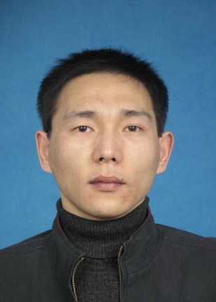
张金平,男,湖北黄冈人,1978年出生,湖南科技大学地球科学与空间信息工程学院测绘工程系教师,博士,讲师。
主要从事摄影测量与遥感空间数据处理与分析等方面的研究。发表论文10余篇,其中被EI、CSCD收录7篇,参加国家自然科学基金重点项目、湖南省科技厅计划项目、湖南省教育厅计划项目10余项。
发表论文:
[1]Jingxiong ZHANG, Jinping ZHANG, Yunwei TANG, Jiong YOU. Spatio-temporal contextual approaches to mapping land cover change based on remote sensing imagery. ISSA 2009. Volume 7492, pp. 74923Y-74923Y-9 (2009). (EI收录)
[2]Jingxiong ZHANG, Jinping ZHANG, Na YAO. Uncertainty characterization in remotely sensed land cover information. Geo-Spatial Information Science. 2009, 12(3): 165-171. (CSCD收录)
[3]Jingxiong ZHANG, Jinping ZHANG, Na YAO. Geostatistics for spatial uncertainty characterization. Geo-Spatial Information Science. 2009, 12(1): 7-12. (CSCD收录)
[4]Jingxiong ZHANG, Jinping ZHANG, Na YAO. Uncertainty characterization in spatial categorical information. ICEODPA 2008 vol. 7285, pp. 72853s-1 72853s-10. (EI收录)
[5]Jinping ZHANG, Deren LI, Jingxiong ZHANG. Geo-statistical framework for conflation of heterogeneous geospatial data. MIPPR 2007, vol. 6790,pp. 679038-1 - 679038-7.(EI收录)
[6]Xiong RAO, Jinping ZHANG, Brain M Steele, Roland L. Generalized linear models for mapping land cover using satellite measurement and digital terrain data. Geoinformatics 2007, vol.6751, pp.675108-2 – 675108-10. [EI检索]
[7]叶志伟, 张金平, 赖旭东. 基于粒子群算法的最大交叉熵的图像分割方法, 安徽农业科学, 2007, 35(23), pp.7037-7041.
[8]侯文广, 张金平, 陈大为. 一种基于电子激光经纬仪和数码相机的结构光工业测量系统, 测绘通报, 2006, 11, pp.68-70. (CSCD收录)

